

Bespoke Property Maps
Hand-drawn maps of estates, farms, ranches, plantations and sporting land, by Anthony Pelly
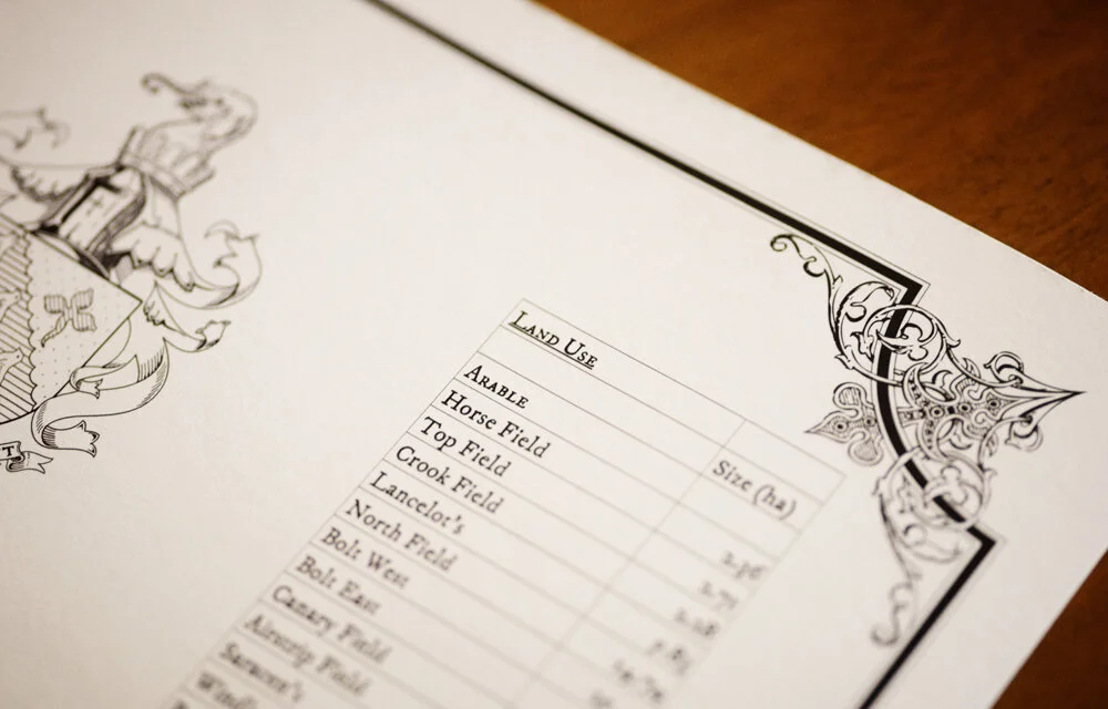
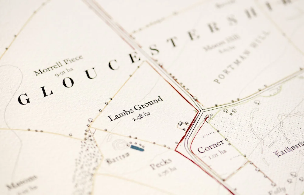
Anthony Pelly makes bespoke maps of estates, family farms and vineyards, of ranches, sporting plantations and grouse moors, for clients in Britain, the United States and beyond. Each records a place as the people who know it understand it: every named field, drive and covert, set down to hang on the wall and added to as the land changes.


What Anthony Maps
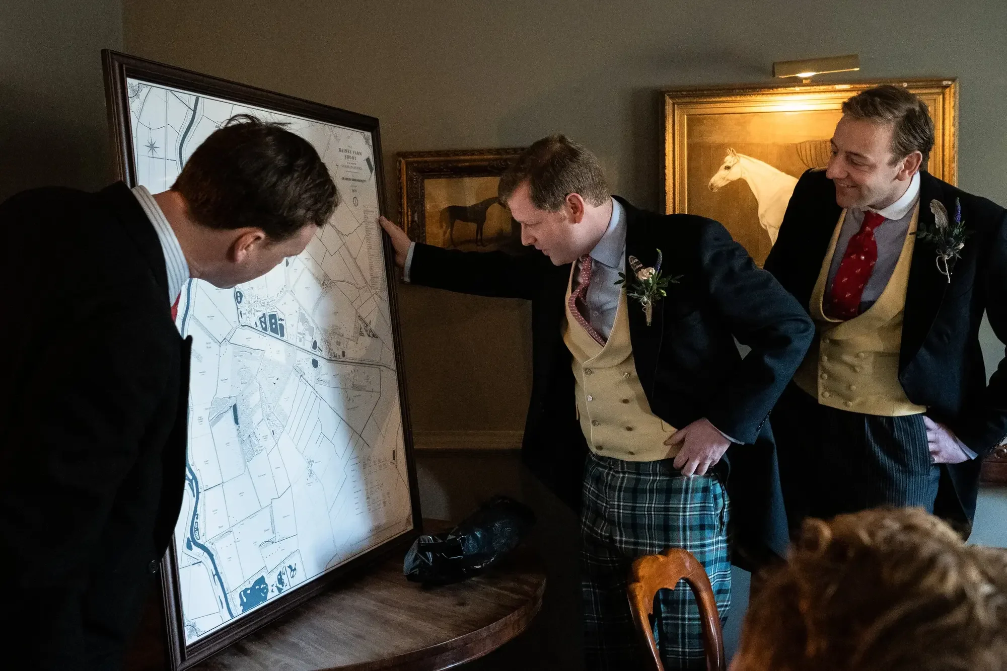
Country estates recorded in full, from the parkland to the furthest let farm.
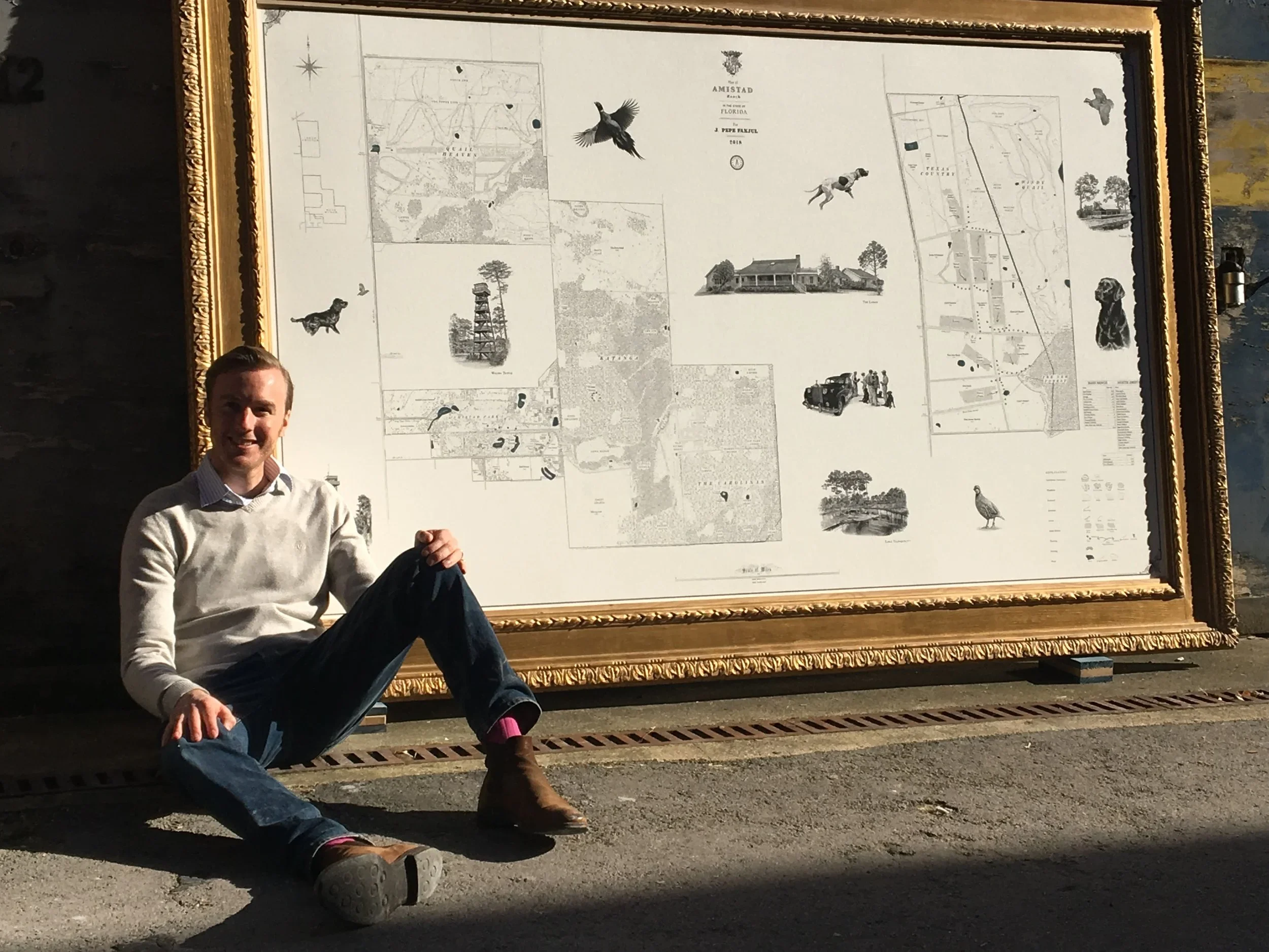
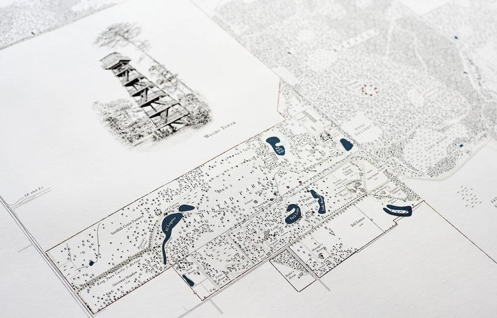
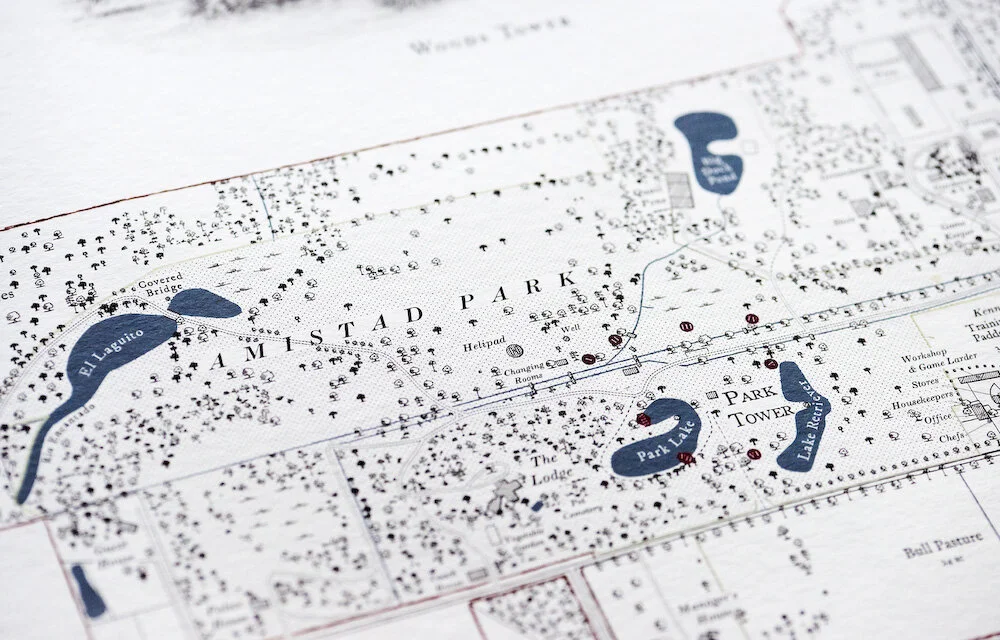
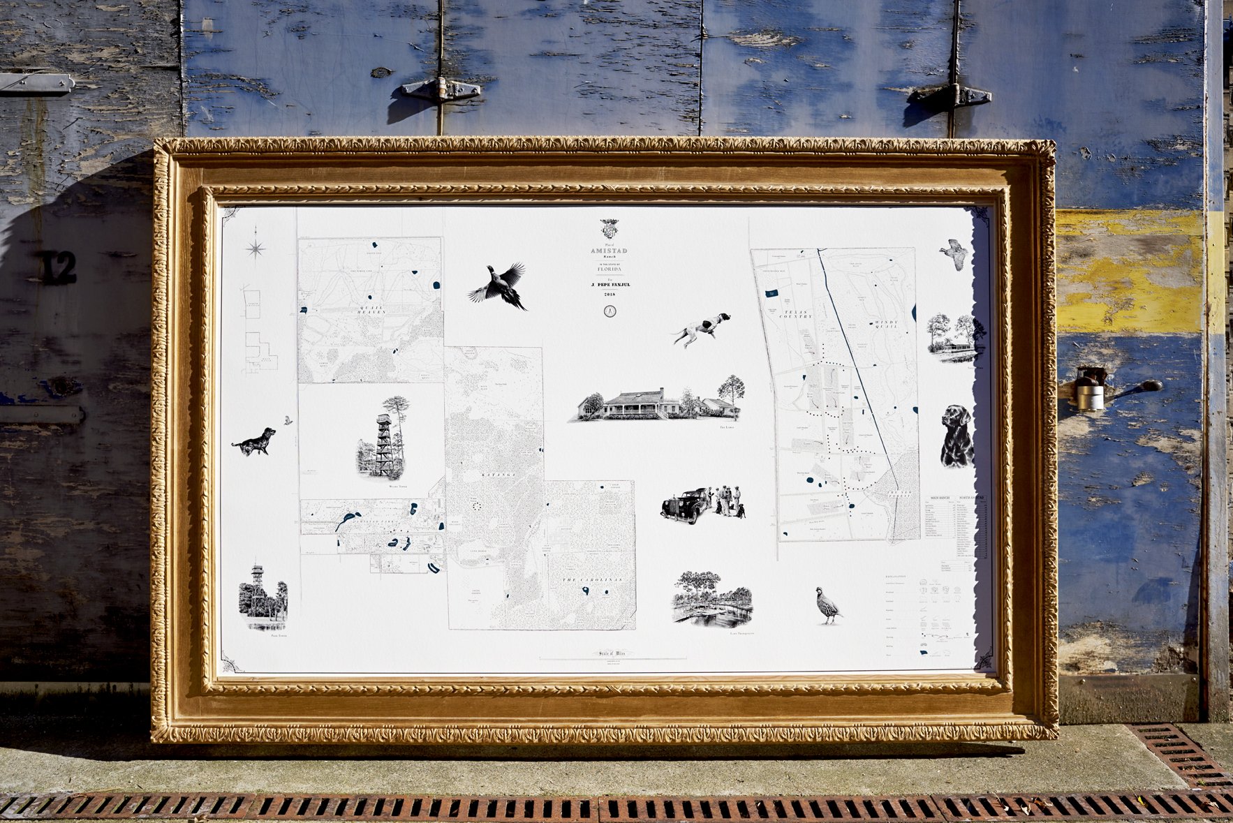
The sporting plantations of the South: quail woods, dove fields and the names of the ground.
Blocks, varietals and rows, drawn with the care given to the house.
A river mapped along its length: beats, pools and lies.
The American West at the scale it deserves: ranges, water and the working divisions of the land.
Driven grouse country, drawn as a portrait of the hill.
Pocket maps for the shoot day, drawn from the same survey as the wall map.
Two Ways to Commission
The Studio Map
Composed remotely in the studio from survey data, boundary records and aerial imagery, without a site visit. A faithful record of the land, best suited to smaller or simpler properties. Field and woodland names, boundaries and land use, drawn and lettered to the same cartographic standard as every Rural Maps commission.
The Full Commission
Begins with Anthony on the land, often across more than one season: walking the boundaries, driving the tracks, talking to the keeper, the manager and the family. The map is drawn from the survey he gathers on the ground, and that is where the depth comes from: the history, the archaeology, the names recorded nowhere else, the hidden details and the original illustrations.
Indicative figures for both are given on the pricing pages.
“Maps commissioned by country estates are valuable historical records as well as being aesthetic objects”
“Producing some of the finest bespoke maps today. They would look the part in shoot lodges, farm offices and drawing rooms across the world.”

To discuss a commission, or to request a sample draft posted to you, please get in touch.
Frequently Asked Questions
-
It begins with a conversation about your property and what you’d like the map to capture. Anthony will discuss scope, likely site visit requirements, and a rough timeline. Most decorative commissions take between four and nine months from first discussion to delivered print.
-
Yes — for almost all decorative commissions. The site visit is where most of the real work happens: walking boundaries, talking to the people who know the land, finding what the data providers don’t know. For larger properties this may mean multiple visits across more than one season.
-
The survey work is largely Anthony’s own. What he asks of you is your knowledge: time walking the land together, access to records and memories, and the chance to talk to the people — keepers, managers, farm hands — who know the property best. Either way, the land gives up its secrets.
-
Most clients don’t. There are two options. The first is to commission now and update later — around a fifth of the studio’s annual work is returning to maps already made, adding new woodland, new buildings and new illustrations as the property evolves. The second is to map the finished vision rather than the current state. At a Wiltshire estate, an extensive parkland design still under construction was mapped complete — giving the client a permanent record of what the estate will become. Being mid-project is never a reason to wait.
-
Yes — for commissions involving significant historical depth. The condensed history of the property, divided by era, is typeset and embedded within the framed print as a formal written panel. The history does not exist separately from the map. It is part of the object.
-
Item descSurvey work is conducted using handheld GPS equipment, typically accurate to within a few feet. At the scales at which these maps are produced — usually between 1:5,000 and 1:22,000 — that is entirely adequate. A few feet on the ground is invisible at map scale. What matters is comprehensive coverage: walking every boundary, driving every track, finding every feature that no satellite image or Ordnance Survey sheet has recorded. This is not engineering survey work with theodolites and total stations. It is thorough, intelligent ground-level observation by someone who knows what a map of this kind needs to contain.ription
-
Yes. Returning to maps already made is a regular part of the studio’s work: new land purchases, additional tree planting, new buildings, updated illustrations. The map is a living document and can be reprinted as the property evolves.
-
Yes — physical archaeological sites are identified, located and plotted at their precise positions, numbered with Roman numerals that link to a chronological timeline beside the border. Mesolithic, Roman, medieval and Victorian periods can all be represented on the same sheet as the working estate.
-
Maps are printed in London and shipped worldwide. Momart handles custom crating, shipping, customs and white-glove delivery. Maps have been delivered to clients across the United States, Europe, Australia and South America.
-
Studio maps — produced without a site visit — start from £10,000. Full commissions with a site visit start from £40,000. US and international commissions start from $45,000. Please see the pricing page or contact us to discuss your property.