

Fishing & River Beats
Bespoke maps of a river, drawn along its length: beats, pools and lies
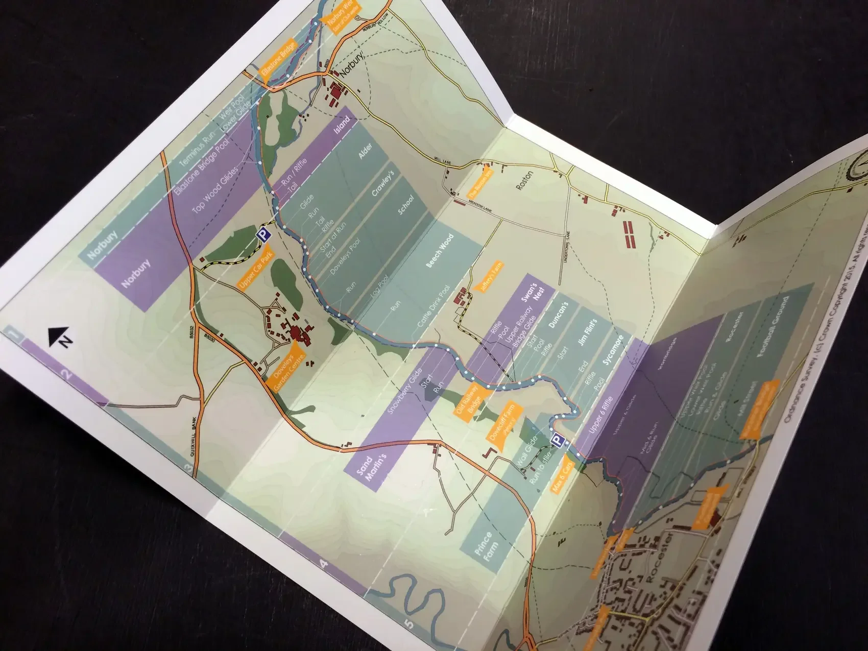
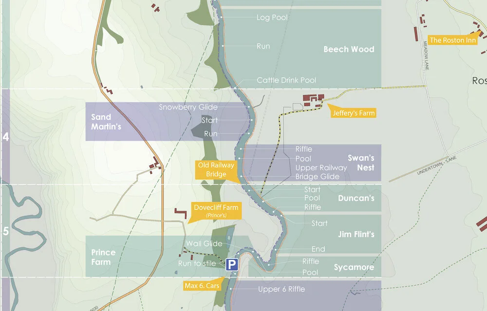
A river is known pool by pool. The named lies and runs, the holding water and the lies that only fish in a certain height, the beats and their boundaries, the hut, the bridge, the bank a ghillie knows by heart. None of it is on any printed map, and it lives mostly in memory. Rural Maps sets it down: the water as those who fish it understand it, drawn along the length of the river and made to hang in the hut or the hall.
A fishing map can stand on its own, a single river or beat, or form part of a wider estate map where the fishing is one of its sporting assets. Either way it is drawn from survey, and to the same cartographic standard as every commission.
What the Map Records
Every river is different. A fishing map will typically hold:
Every named pool, run and lie
The beats and their boundaries
Holding water, croys, groynes and weirs
The fishing hut, bothy, bridges and access
Banks, paths and the wider riverside ground
Tributaries, falls and the river's course
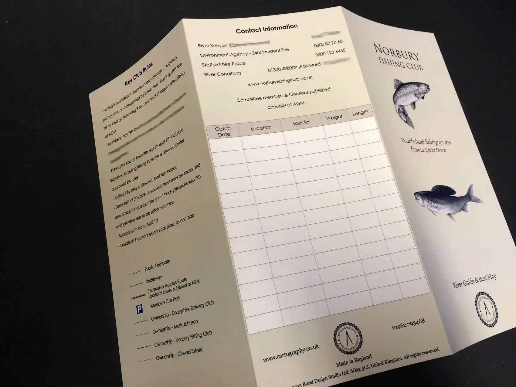
A note of the named places and what they mean, set within the print
“Having just received our commissioned fishing beat map, for Norbury, we must put on record, that it meets the club requirements exactly. The patience and assistance in the preparation, was appreciated, for what is, an excellent outcome. I have no hesitation in recommending your work to other fishing clubs.”
