

Estate Maps
Bespoke maps of country estates, shoots and farms, in Britain and beyond
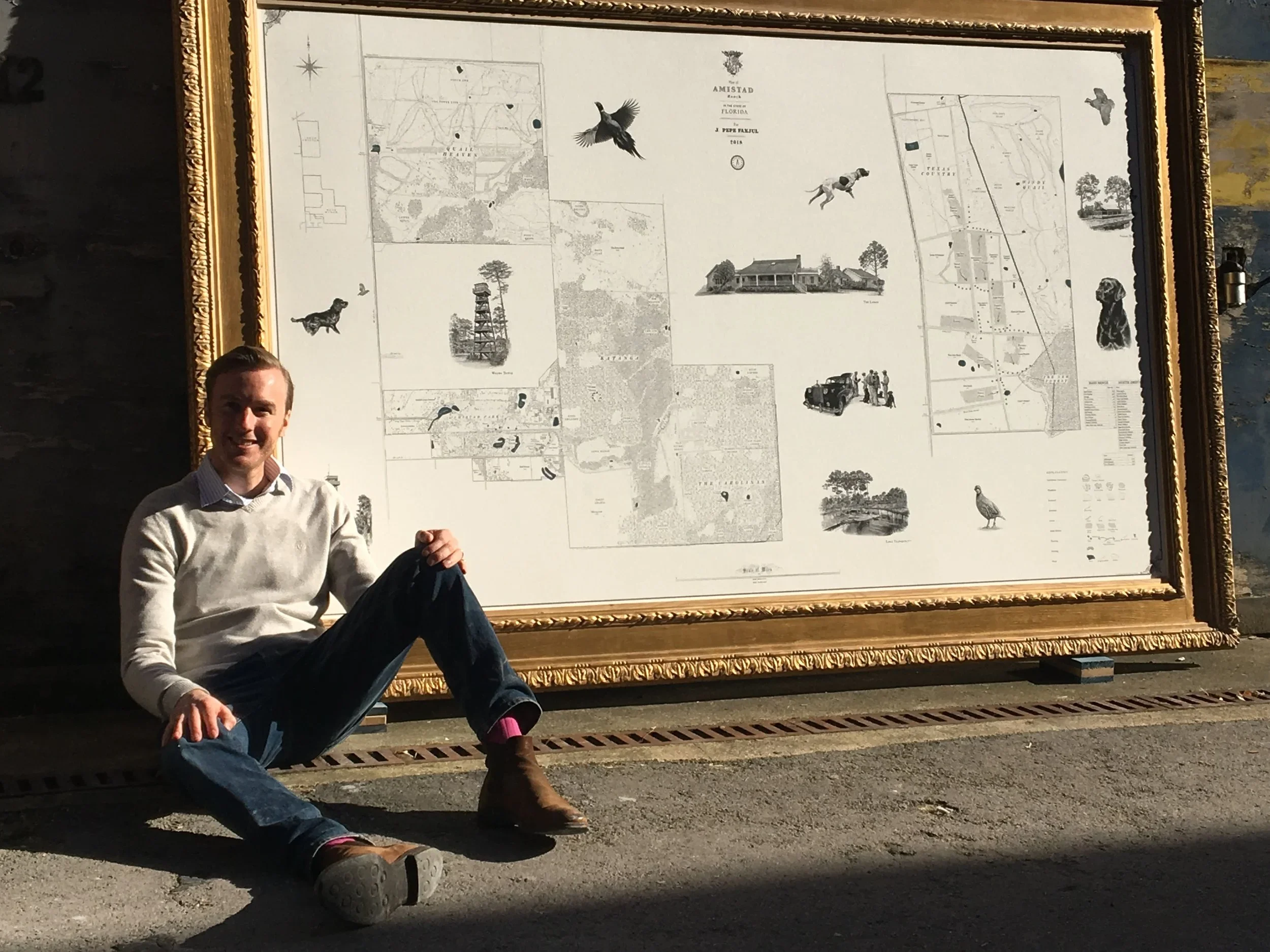


An estate is more than its boundaries. It is the driven shoots and the farm roads, the ancient woodland and the parkland avenues, the keeper's name for every stand and the family's name for every field. None of it appears on an Ordnance Survey sheet, and no data provider holds it. A Rural Maps commission records all of it: the land as its owners and managers know it, set down at a level of detail no other map reaches.
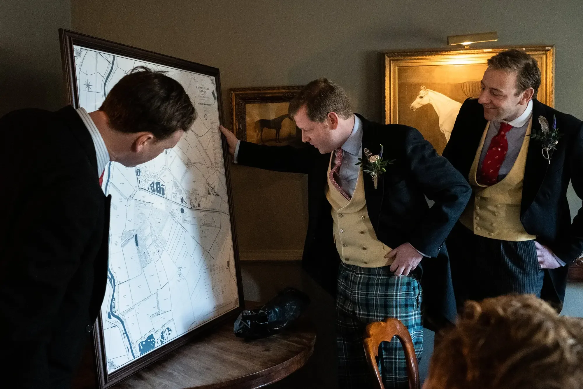
The finished map hangs in the drawing room, the estate office, the gun room or the lodge. It is studied by guests who know the land and by those seeing it for the first time. Children find hidden illustrations in it years later. It is updated as the estate changes, and grows with it.
What the Map Records
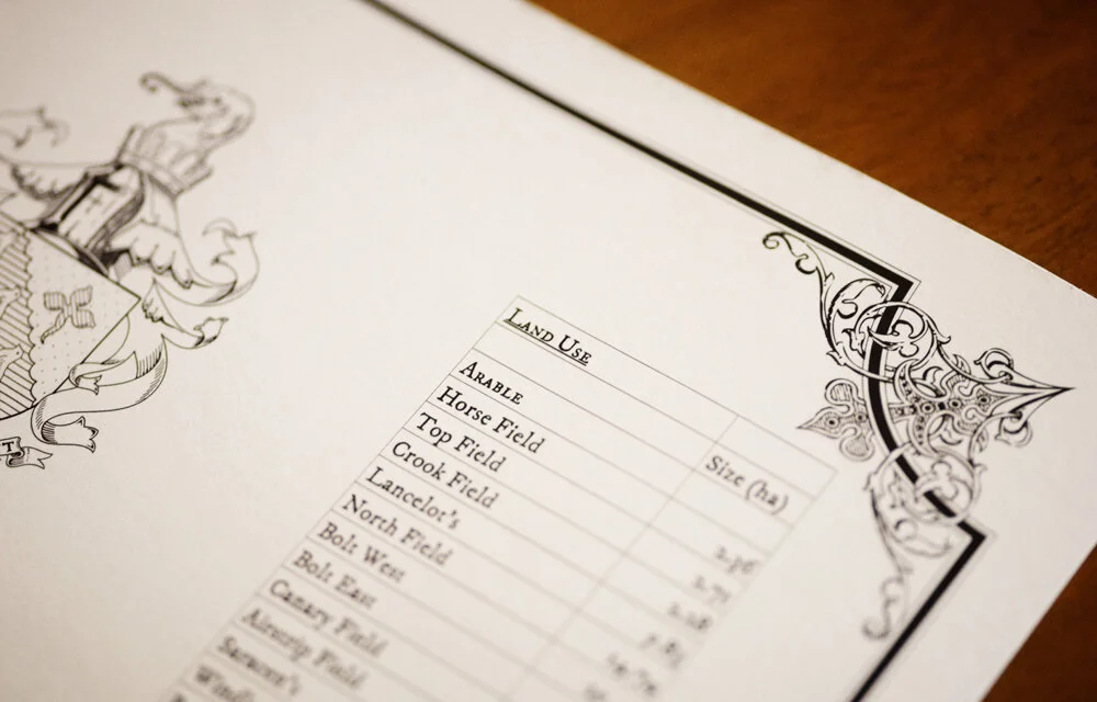
Every commission is different. A fully surveyed estate map will typically hold:
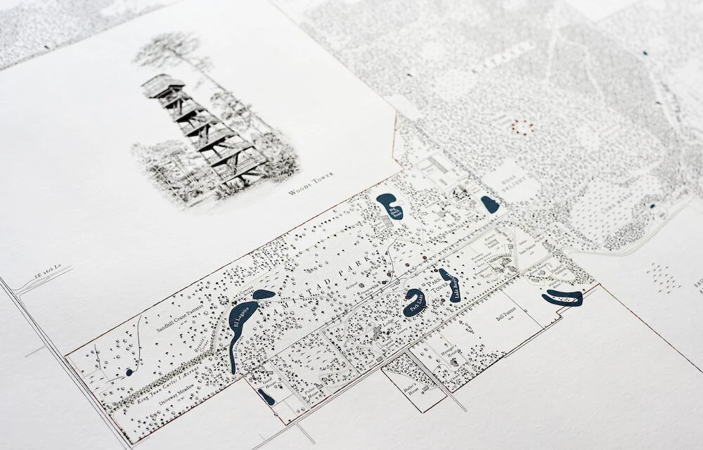
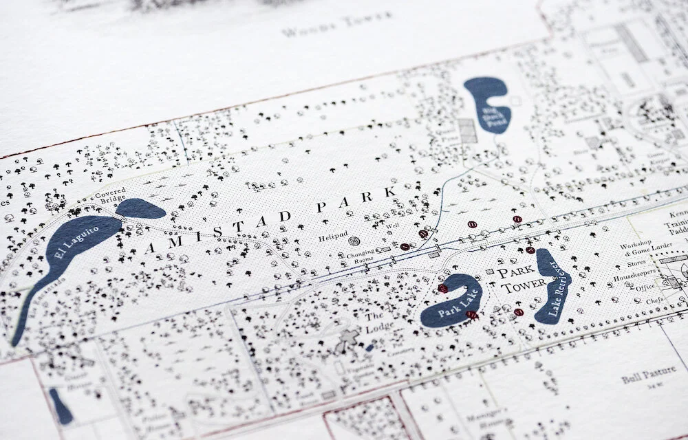
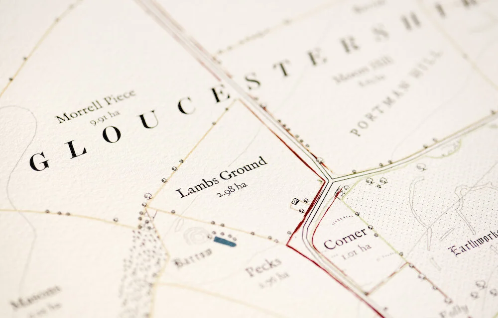
Every field, drive, wood and parkland named as the estate knows them
The house, farm buildings, cottages and lodges, drawn to scale
Roads, tracks, rides, footpaths and rights of way
Rivers, lakes and ponds
Sporting features: drives, flushing points, release pens, high seats, fishing beats
Boundaries: ownership, tenancy, sporting rights, environmental schemes
Archaeology, plotted to position and linked to a timeline along the border
A condensed, era-by-era history of the property, and the meaning of every named place, set within the print
Two Ways to Commission
The Studio Map
Composed in the studio from survey data, boundary records and aerial imagery, without a site visit. A faithful record of the estate, best suited to smaller or simpler properties. Field and woodland names, boundaries and land use, drawn and lettered to the same standard as every Rural Maps commission. From £11,000.
The Full Commission
Begins with Anthony on the estate, often across more than one season: walking the boundaries, driving the tracks, talking to the keeper, the manager and the family. The map is drawn from the survey he gathers on the ground, and that is where the depth comes from: the history, the archaeology, the names recorded nowhere else, the hidden details and the original illustrations. From £25,000.
Both scale with size, complexity and the depth of research. Full figures are on the UK and US pricing pages.
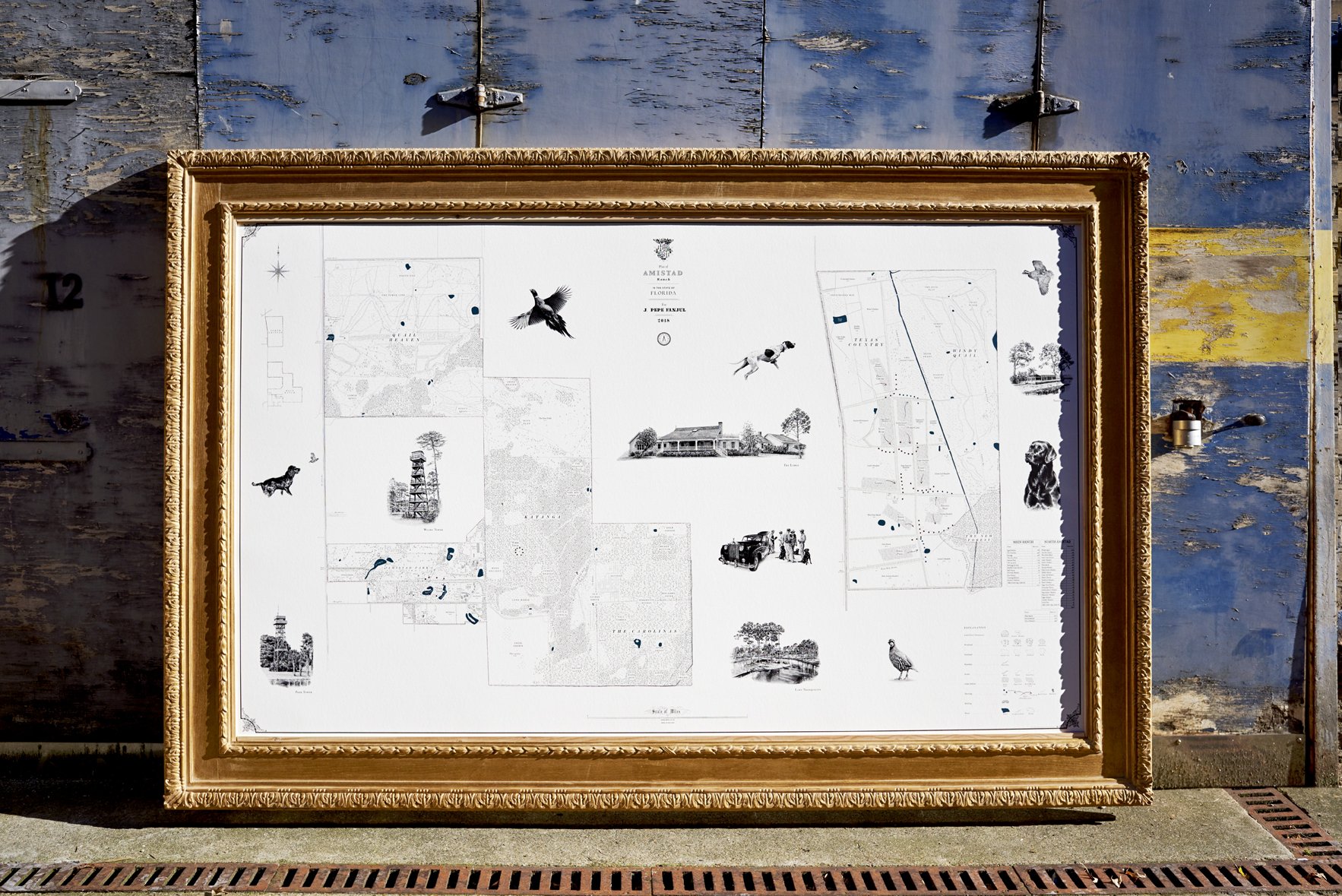
The Illustrations
Where a map carries illustrations, they are the work of the artist Jonathan Pointer, drawn from photographs taken on site or supplied by you: the house, the dogs, game scenes, the family arms, a vignette of the parkland, each drawn to your property and to no other. The originals are yours to keep on completion.
Something hidden
Inspired by time spent on the land, Anthony hides small illustrations within each map: a family dog at the edge of a wood, a figure from the history of the place, a private detail only those who know the land will find. He does not say what they are, or where. They stay there for the family to discover, for years and generations to come.
Printing, Framing and Delivery
Every map is printed on heavyweight, archival Giclée paper by a specialist fine-art printer in London. Framing can be arranged through Derek Tanous, one of Europe's finest traditional framers, who works with two-hundred-year-old wooden moulds. International shipping and white-glove delivery are handled by Momart, the fine-art shippers, with full customs documentation, wherever in the world the estate lies. Many clients commission further framed copies for other homes, offices or yachts.
Beyond the frame
The survey behind the map does not end on the wall. Where it is useful, the same data is delivered as a working tool for those who run the estate: a colour-coded board for the office, and an app (LandApp in Britain, LandID in the United States) through which managers, keepers and contractors can turn layers on and off, see their position on the ground, and navigate the property offline, beyond mobile signal. The map hangs in the house; the survey that made it goes on working in the field.
“Maps commissioned by country estates are valuable historical records as well as being aesthetic objects”
“Producing some of the finest bespoke maps today. They would look the part in shoot lodges, farm offices and drawing rooms across the world.”
Recent estate commissions: read the full case studies of Williamstrip Park, Gloucestershire, our Cotswolds estate knowledge capture commission, and Blenheim Palace.
Frequently Asked Questions
-
For a full commission, yes. Anthony typically spends several days on site, sometimes across more than one season, walking boundaries, driving tracks and talking to the keepers, managers and farm hands who know the ground. A studio map, made without a visit, is available for smaller or simpler properties.
-
It is one of the most common reasons to commission a map, particularly where an estate has changed hands after generations. The survey recovers what the outgoing family knew, records what the land actually holds, and makes sure nothing leaves with the people departing.
-
Most clients don't. A map can be made now and updated later, around a fifth of each year's work is returning to maps already made. Or the estate can be drawn as it will become rather than as it stands: at one Wiltshire estate, a parkland still under construction was mapped complete, giving the owners a record of the finished vision in advance.
-
Yes. New land, new planting, new buildings, further illustrations: returning to maps already made is a regular part of the work, and the map grows with the property.
-
Yes. Physical sites are plotted to position and numbered to a timeline along the border, spanning Mesolithic to Victorian on a single sheet. Where a property's history runs deep, it is researched in full and a condensed, era-by-era account is set within the framed print.
-
Studio maps begin at £11,000, full commissions with Anthony on site at £25,000, scaling with size, complexity and research depth. US commissions begin at $25,000. Framing is arranged and priced separately. Full figures are on the pricing pages.

Anthony takes on a small number of commissions each year. To discuss your estate, or to request a sample draft posted to you, please get in touch.