

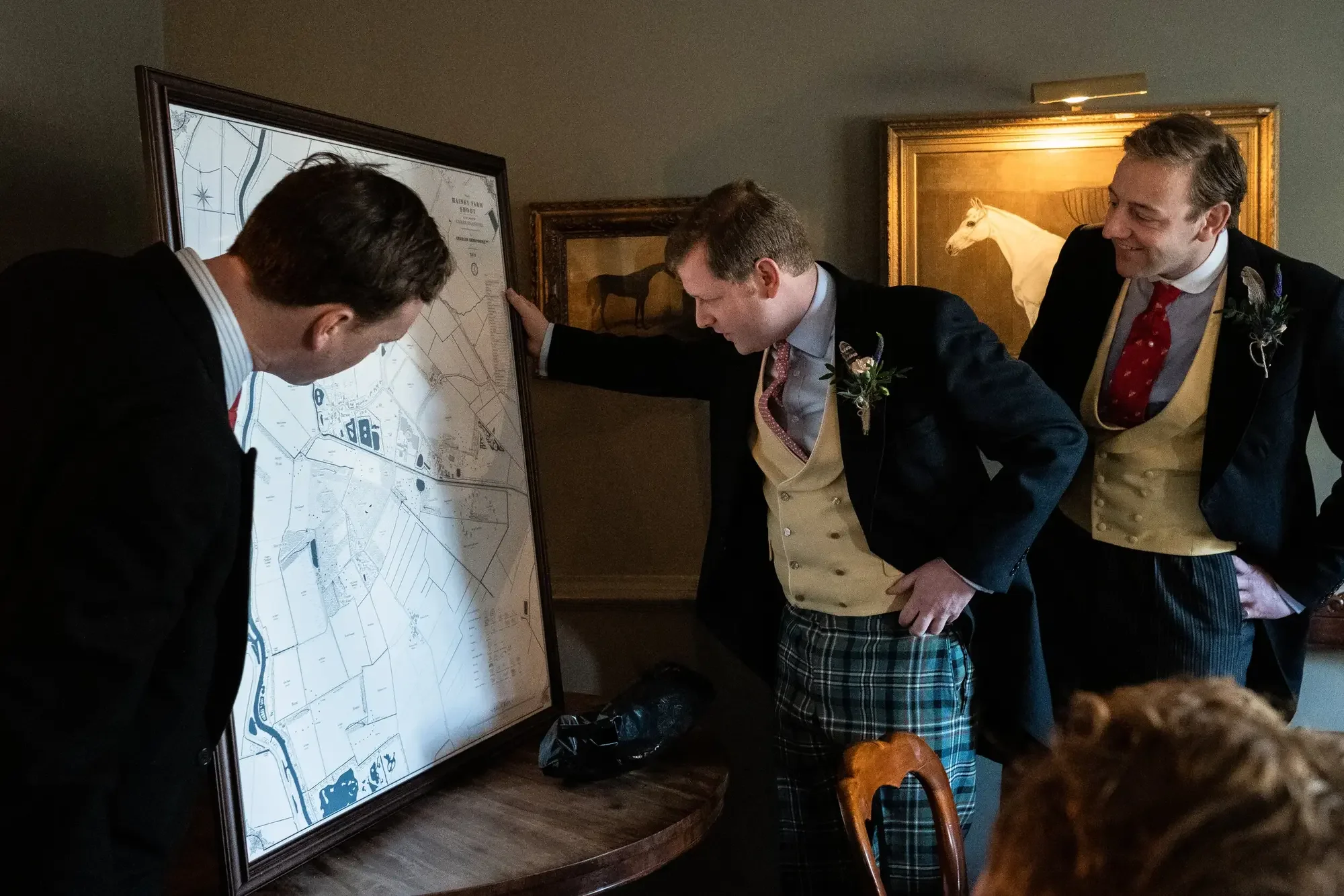
Plantation Maps
Bespoke maps of the sporting plantations of the American South
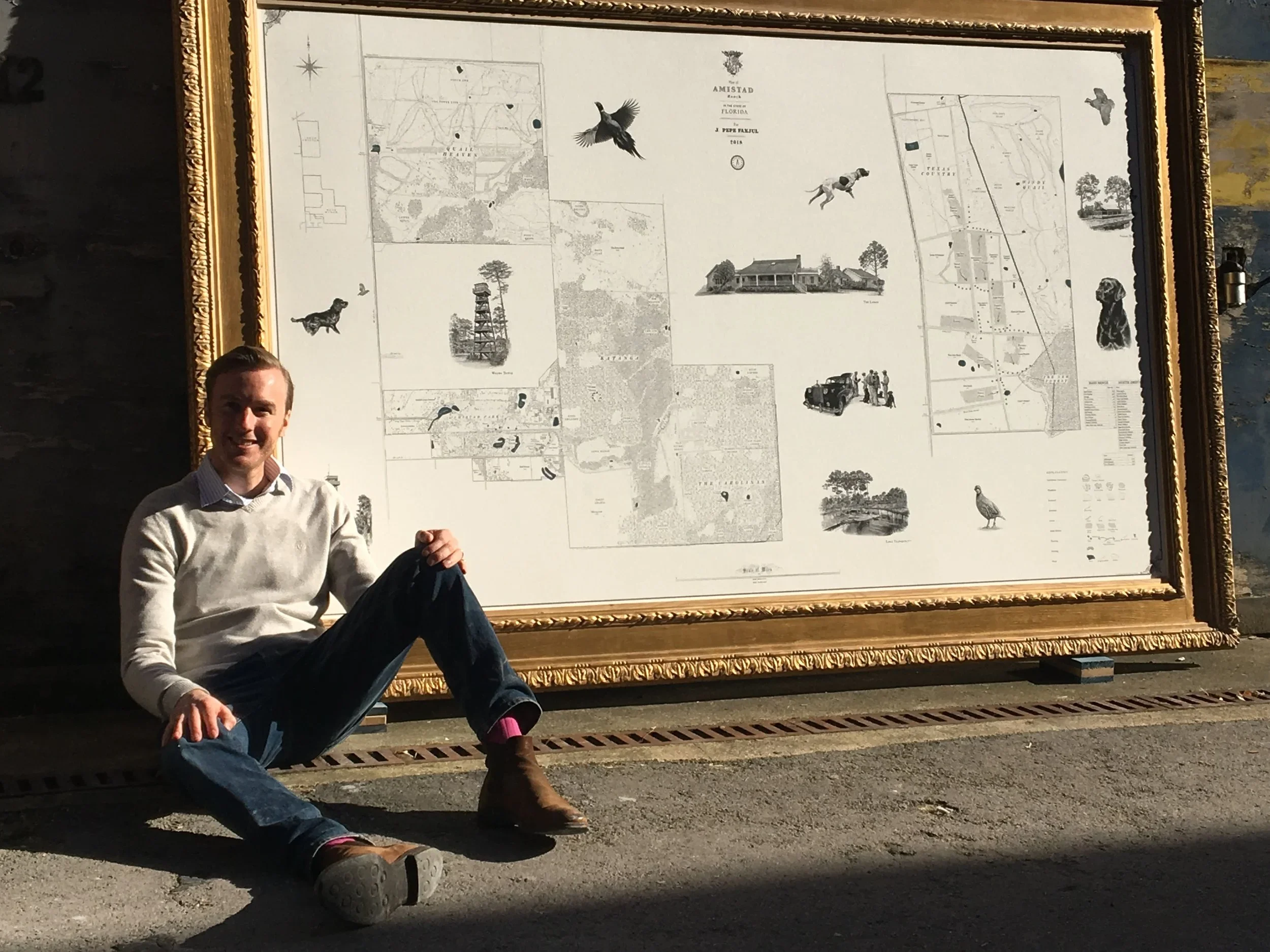


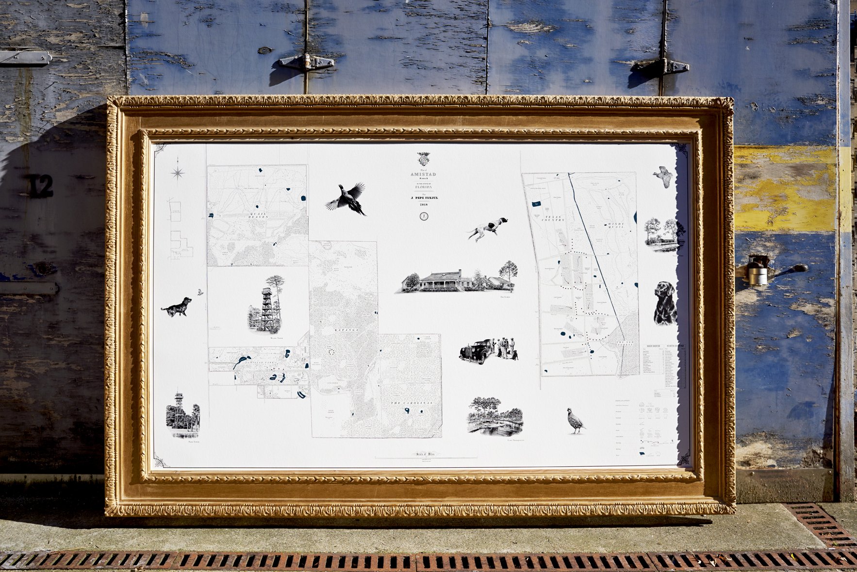
On a quail plantation the land is known by its sport and its history in equal measure: the courses worked by the dogs, the dove fields and food plots, the named woods and coverts, the lodge and the kennels, and beneath all of it the story of the ground and the families and peoples who held it before. A Rural Maps commission records both, the plantation as it is run today and the centuries behind it, set down on a single sheet to hang in the lodge or the hall.
Anthony Pelly has mapped sporting plantations across Alabama, Florida and the wider South. Each map is drawn from his own survey of the land, and from research that reaches back as far as the records run.
“Pelly’s classical masterpieces visually tell a tale - preserving the culture and foundation of our ‘places’”
What the Map Records
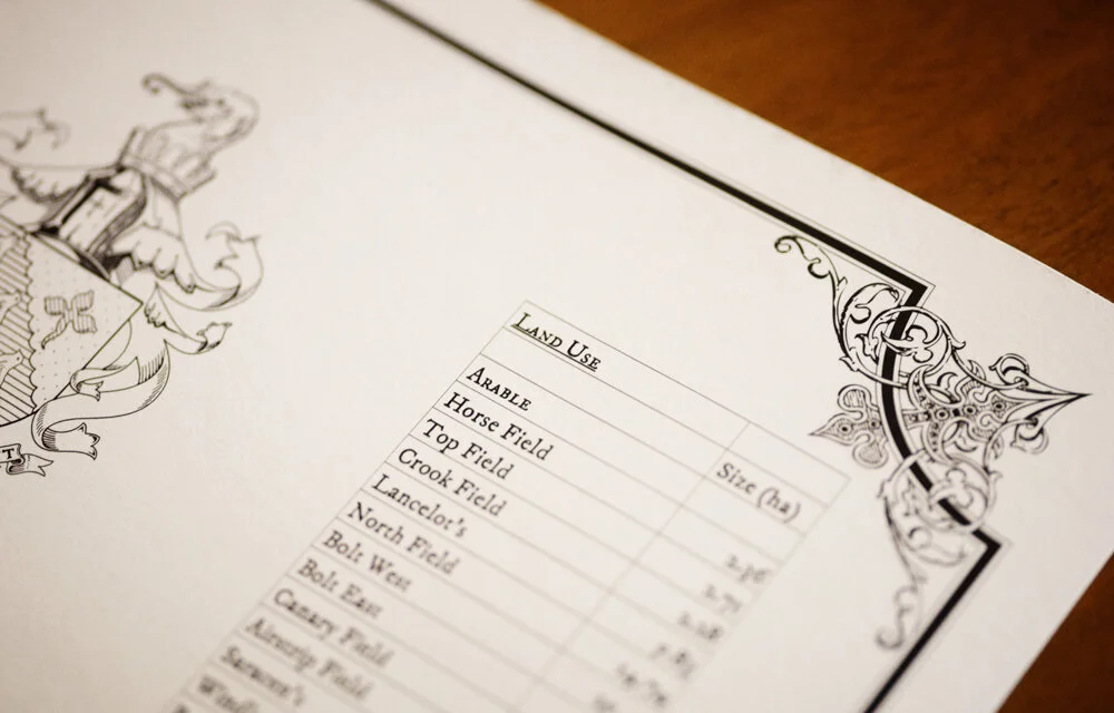
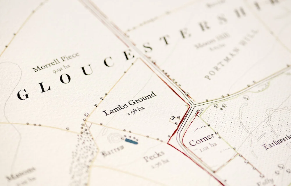
Every plantation is different. A fully surveyed map will typically hold:
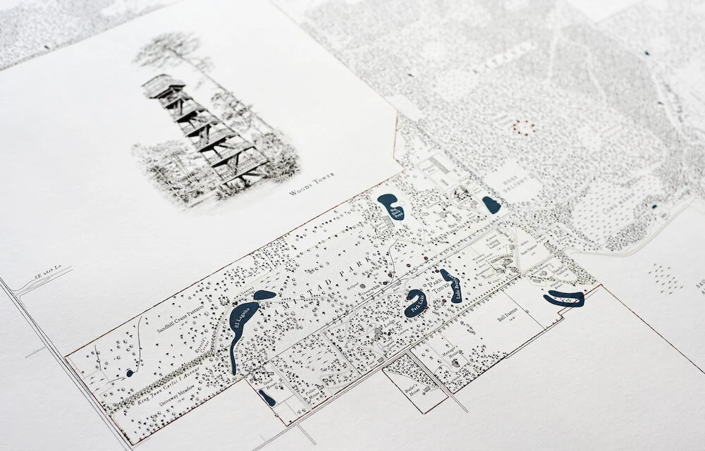
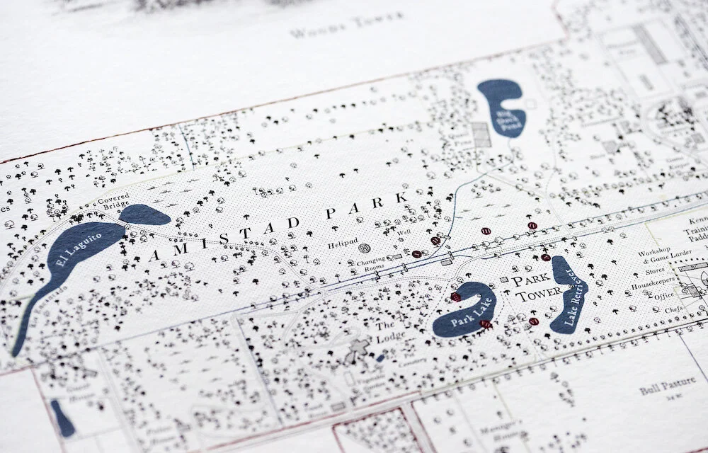
The quail courses and dove fields and the food plots
Every wood and covert, named as the plantation knows them
The lodge, kennels, dog barn, cottages and outbuildings, drawn to scale
Deer stands, blinds and towers
Roads, trails and rides
Creeks, lakes and ponds
Boundaries: ownership, hunting rights and neighbouring ground
Historic sites plotted to position: old cemeteries, churches, homesteads and native trails
A condensed, era-by-era history of the land, set within the print
History and Heritage
In the South a plantation's history is often its deepest asset, and the part no survey can supply. Where the records run deep, Anthony researches them in full: county archives, estate papers, oral histories from those who know the land. The condensed history of the property is then set within the framed print itself, divided by era, so the map is at once a record of the ground and of everyone who has held it.
At Sedgefields, a ten-thousand-acre quail plantation in Alabama's Black Belt, that research reached back two hundred years, much of it from county archives known to almost nobody outside the county: lost cemeteries and churches, Muscogee Creek trails, nearly a hundred vanished homesteads, and seventy-five thousand individual trees surveyed. The map now hangs in the hall by the front door, the first thing family and guests see. Its owner, Raymond Harbert, had a history of the place written over thirteen years; when the map was finished, he asked Anthony to add a chapter to it, for what the survey had found that the archive had not.
The Illustrations
Where a map carries illustrations, they are the work of the artist Jonathan Pointer, in pencil and gouache: the pointers and setters, a covey rising, the lodge in its setting, the wildlife of the ground. Each is drawn from photographs taken on site, to your plantation and no other, and the original drawings are yours to keep on completion.
Something Hidden
Inspired by time spent on the land, Anthony hides small illustrations within each map: a favourite dog at the edge of a wood, a figure from the plantation's history, a private detail only those who know the ground will find. He does not say what they are, or where. They stay there for the family to discover, for years to come.
Two Ways to Commission
The Full Commission
Begins with Anthony on the plantation: walking the courses, driving the trails, talking to the manager, the dog men and the family, and researching the history in full. The map is drawn from the survey he gathers on the ground. This is the commission behind the plantations described here. Plantation commissions begin at $30,000 and scale with acreage, detail and the depth of research.
The Studio Map
For a smaller or simpler property, a map can be composed in the studio from survey data and aerial imagery, without a site visit, drawn to the same standard as every Rural Maps commission.
Full figures are on the US pricing page.
Printing, Framing and Delivery
Every map is printed on heavyweight, archival Giclée paper by a specialist fine-art printer in London, then crated, shipped and delivered to your door by Momart, the fine-art shippers, with all customs handled. Framing can be arranged through Derek Tanous, one of Europe's finest traditional framers. The Sedgefields print measures nine feet by five; many clients commission further copies for other homes or the office.
Beyond the Frame
The survey behind the map does not end on the wall. Where it is useful, the same data is delivered as a working tool: a colour-coded board for the office, and an app (LandID in the United States) through which managers and dog men can turn layers on and off, see their position on the ground, and navigate offline, beyond cell signal. The map hangs in the lodge; the survey goes on working in the field.
“Maps commissioned by country estates are valuable historical records as well as being aesthetic objects”
“Producing some of the finest bespoke maps today. They would look the part in shoot lodges, farm offices and drawing rooms across the world.”
Frequently Asked Questions
-
For a full commission, yes. Anthony spends time on the ground, sometimes across more than one season, walking the courses, driving the trails and talking to the people who know the land. A studio map, made without a visit, is available for smaller or simpler properties.
-
Through county archives, estate papers, old maps and the recollections of those who know the land, often alongside a local historian. The findings are distilled into a condensed, era-by-era history set within the framed print itself.
-
Yes. Sites are identified, located and plotted at their precise positions, numbered with Roman numerals linked to a chronological timeline beside the border. Muscogee Creek hunting trails, burial grounds, early European structures and later antebellum sites can all be recorded — each as a cartographic fact, not a footnote.
-
Quail courses, dove fields and food plots; named woods and coverts; deer stands, blinds and towers; kennels and dog barns; fishing runs and beats. The land as the plantation actually hunts it, not as any data provider records it.
-
Printed in London and shipped by Momart, the fine-art handlers, who build a custom case, manage customs, and deliver and install at your door. Maps have gone to clients across the United States and beyond.
-
East Coast and Southern plantation commissions begin at $30,000 for smaller properties with a studio-led approach, and from $50,000 for full commissions with Anthony on site. Research-intensive commissions of the Sedgefields type begin at approximately $175,000 and are quoted individually after a conversation. Framing is arranged separately. A full pricing guide is on the US Pricing page.

Anthony takes on a small number of commissions each year. To discuss your plantation, or to request a sample draft, please get in touch.