

Farm Maps
Clear, accurate maps of working farms, for management and record

A working farm runs better on one good map. Field names and sizes, land use and tenancy, tracks, water and drainage, all in a single, accurate document that everyone on the farm can use. Rural Maps produces farm maps as practical working tools: drawn to the same cartographic standard as every commission, but made for the office wall and the day-to-day running of the land rather than the drawing room.
The Studio Map
Most farm maps are produced as studio maps, composed remotely without a site visit. Working from your boundary records, RPA data, survey information and aerial imagery, Anthony oversees a clear, colour-coded map of the holding: a faithful, well-drawn record of the farm as it is, delivered without the cost of time on the ground.
What it shows
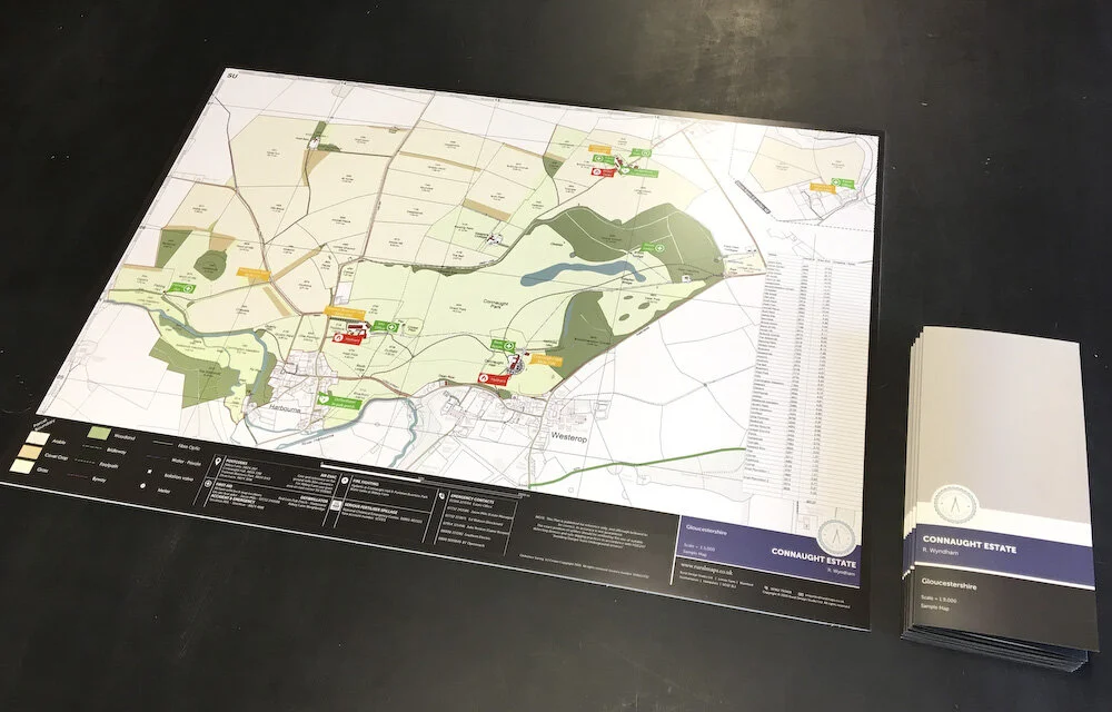
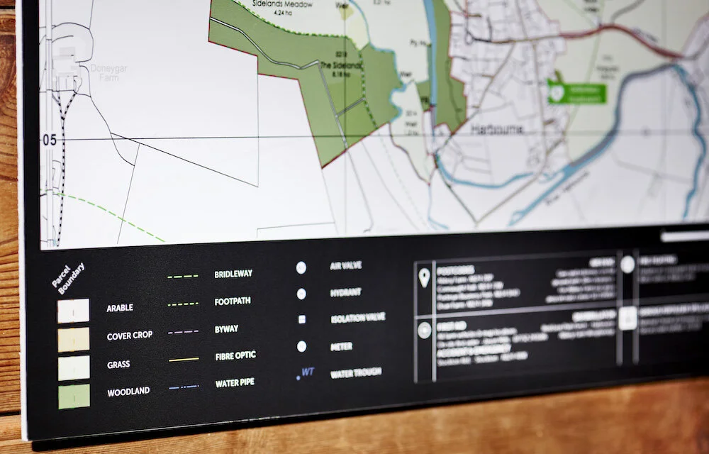
Field, woodland and pasture boundaries, with names and sizes
Parcel IDs and a table of field names, areas and total acreage
Colour-coded land use
Public rights of way and ownership boundaries
Contours and natural water features
Tracks, roads and access
Shoot drives, pegs and flushing points where provided
Each map can include:
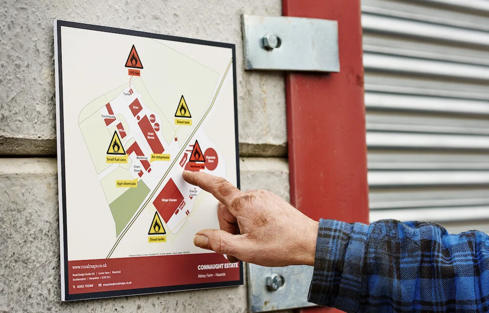
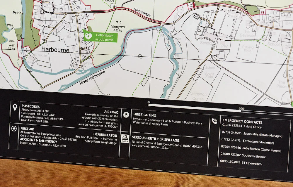
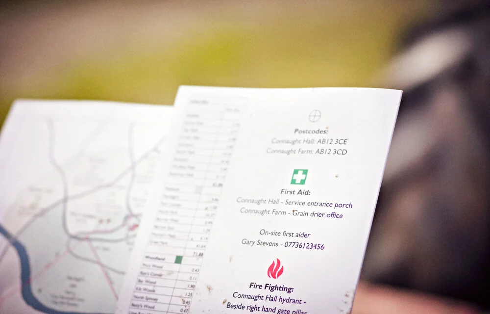
First aid box locations
Local defibrillators
Firefighting points
Important contact numbers
Air ambulance request procedures
Designated evacuation locations
With our farm mapping services, you can improve safety, reduce risk, and respond quickly in critical situations.
Recent farm mapping commission: read the full case studiy of J. Wharton Agriculture.
A Working Tool, Not Just a Wall Map
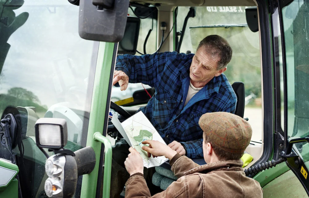
The value of a good farm map is in the using. The survey can be delivered as more than a print: a colour-coded board for the office that wipes clean, and an app (LandApp in Britain, LandID in the United States) through which you, your team and your contractors can turn layers on and off, see your live position in the field, and navigate the holding offline, beyond mobile signal. Cropping plans, drainage, cables, rights and pasture sizes, all in one place, all to hand.
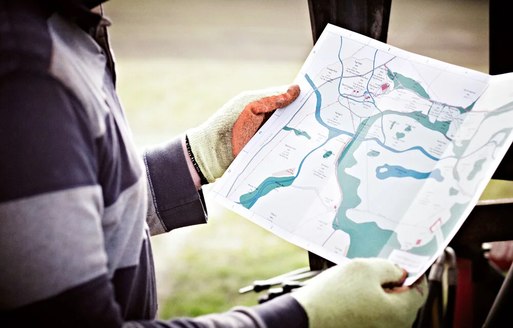
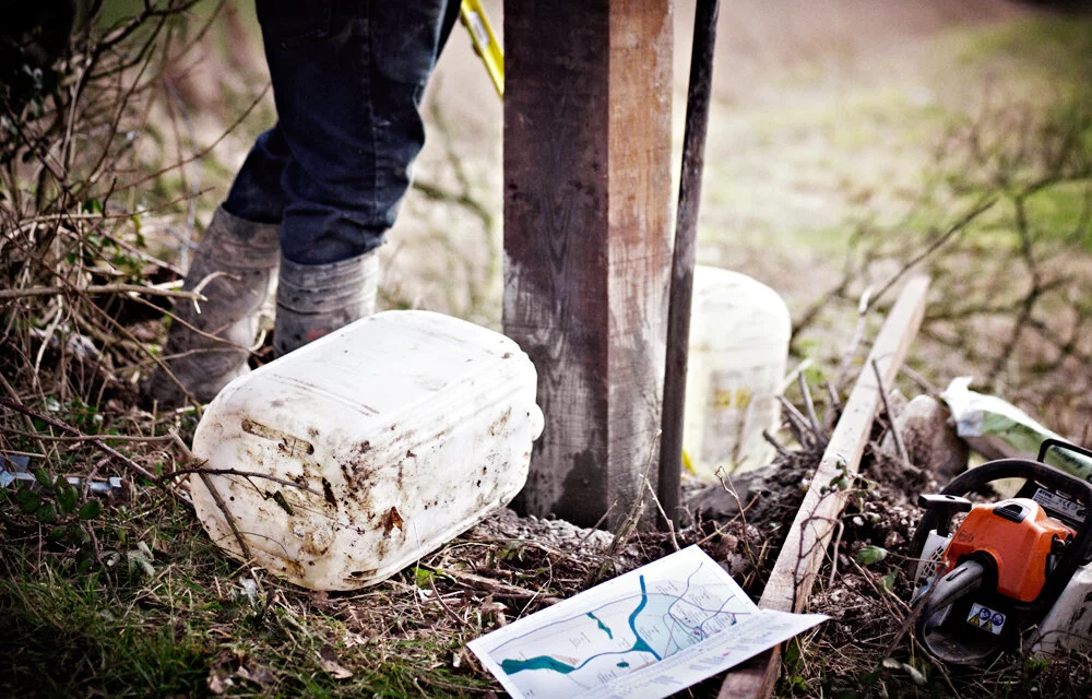
The Full Survey
For larger or more complex holdings, or where the detail matters, a full commission begins with Anthony on the ground: walking boundaries, driving tracks, and recording what no dataset holds, water networks, drainage runs, every chamber, valve and trough, lost access routes recovered. On one Gloucestershire estate this produced a full flow diagram of three mains and three spring-fed systems, hundreds of land-drain outfalls located, and a written report on all services and infrastructure alongside the maps. The survey can be added to and updated as the farm changes.
“When managing a property, you can get most things organized with the help of just one document …. A comprehensive, up-to-date map. Identify what you, your employees, contractors and advisors need to know and map it! Cropping plans, irrigation rights, field sizes, underground cables, historic features, Wayleaves, Easements, title deeds, risk assessments – they can all be referred to in an instant with the help of a map. A good map is a pleasure to use. We recommend Rural Maps. They produce the best maps we have ever seen and supply them promptly in a wide range of useful formats at a reasonable price.”
Discover the process
Explore the process for commissioning a custom farm map.

Frequently Asked Questions
-
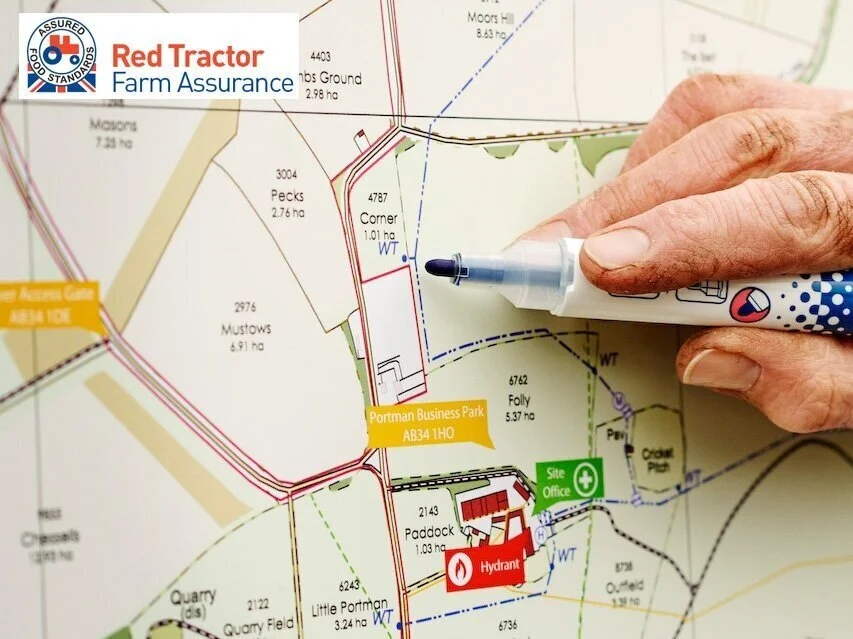
Yes — our maps support Red Tractor Assurance and other compliance standards, with field boundaries, parcel IDs, rights of way and emergency procedure information clearly displayed.
-
Yes. We regularly map underground drainage networks, water pipes, electricity cables and sewage systems. For older properties this often involves investigative work — sourcing historic records and physically locating infrastructure that was never properly documented.
-
Wipe-clean boards for the farm office, folded water and tear-proof A3 maps for vehicles and pockets, and PDF copies. All formats are included as standard.
-
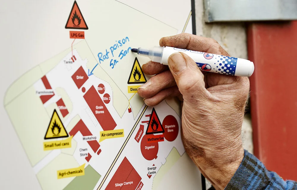
Yes — new field boundaries, new buildings, changed cropping plans, additional stewardship layers. Returning to maps already made is a regular part of our work.