

Ranch Maps
Bespoke maps of the American West
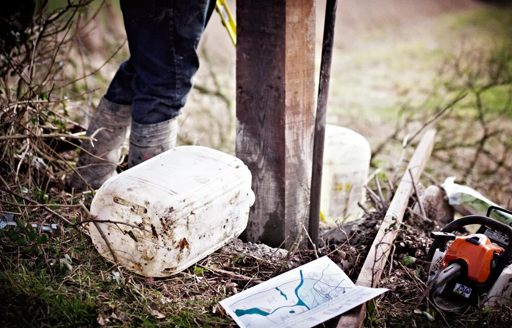
Rural Maps makes high-end, bespoke maps of ranches: hand-drawn, surveyed on the ground by cartographer Anthony Pelly, and made as heirloom pieces to hang for generations.
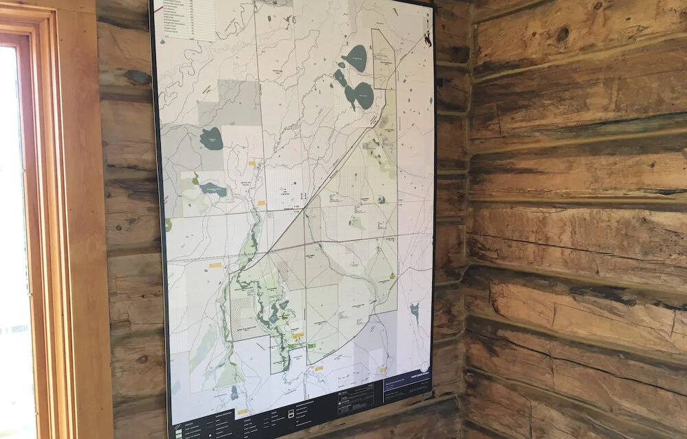
A ranch is held in its names and its history as much as its fences: the pastures and ranges, the creeks and water, the line camps and cow camps, the homesteads of the families who built it and the country they ran. Rural Maps records all of it, the working ground and the generations behind it, on a single sheet to hang in the ranch house. These are working landscapes of tens of thousands of acres, and the map is drawn at a scale that does them justice.
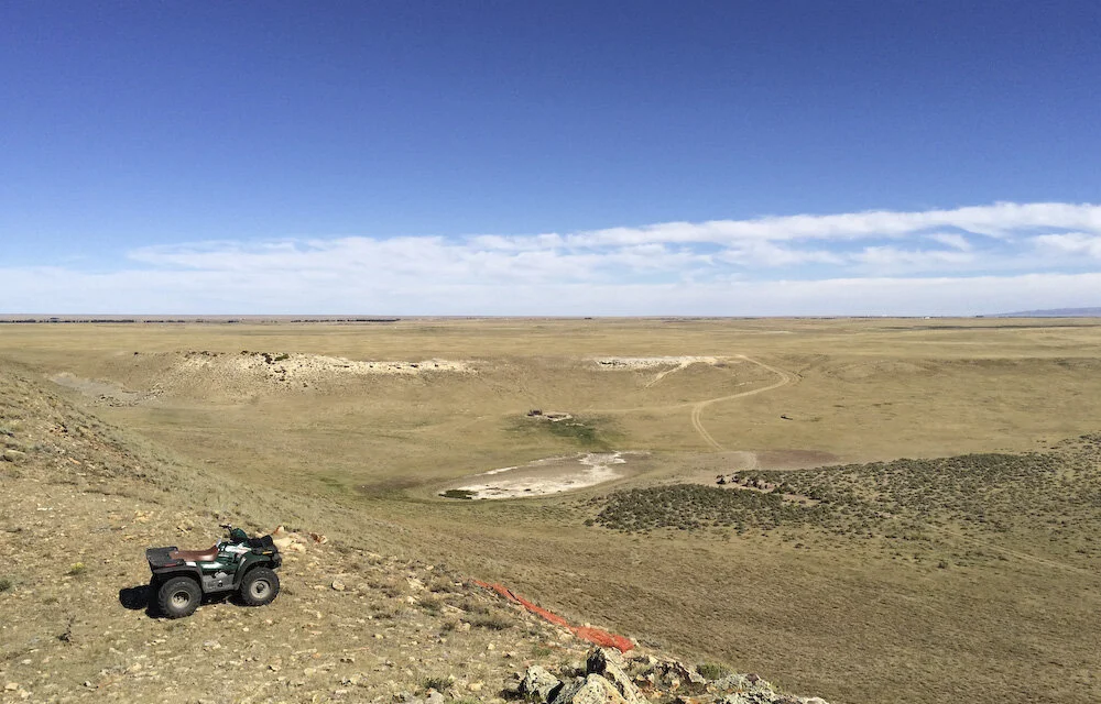
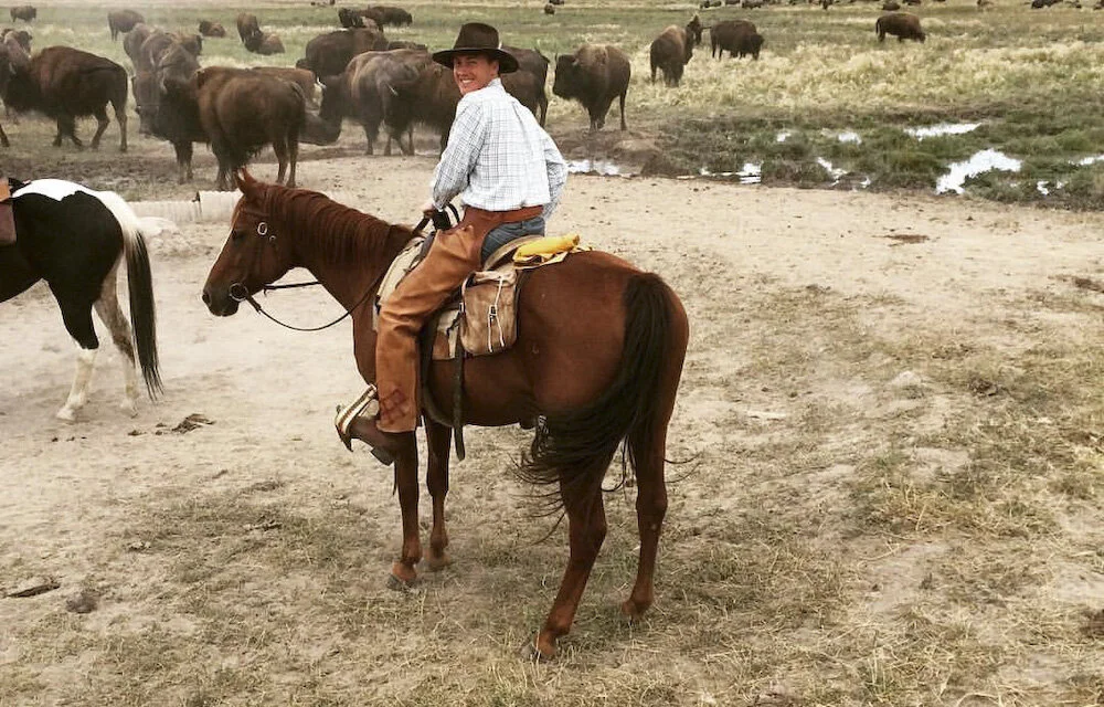
Anthony Pelly has mapped ranches across Colorado, Wyoming, Texas and the wider West, from a few thousand acres to close to a million. He grew up between Hampshire and his family's ranch in Wyoming, and knows ranch country from the saddle as well as the survey.
What the Map Records
Every ranch is different. A fully surveyed map will typically hold:
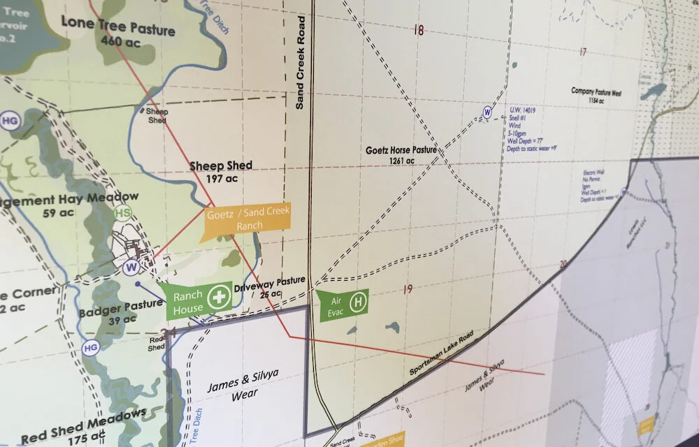
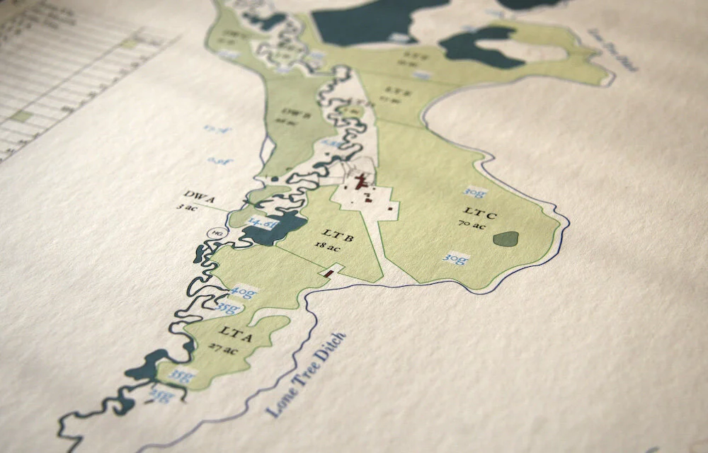
Pastures, ranges and allotments, named and with acreages
Deeded, leased and BLM ground, and the boundaries between them
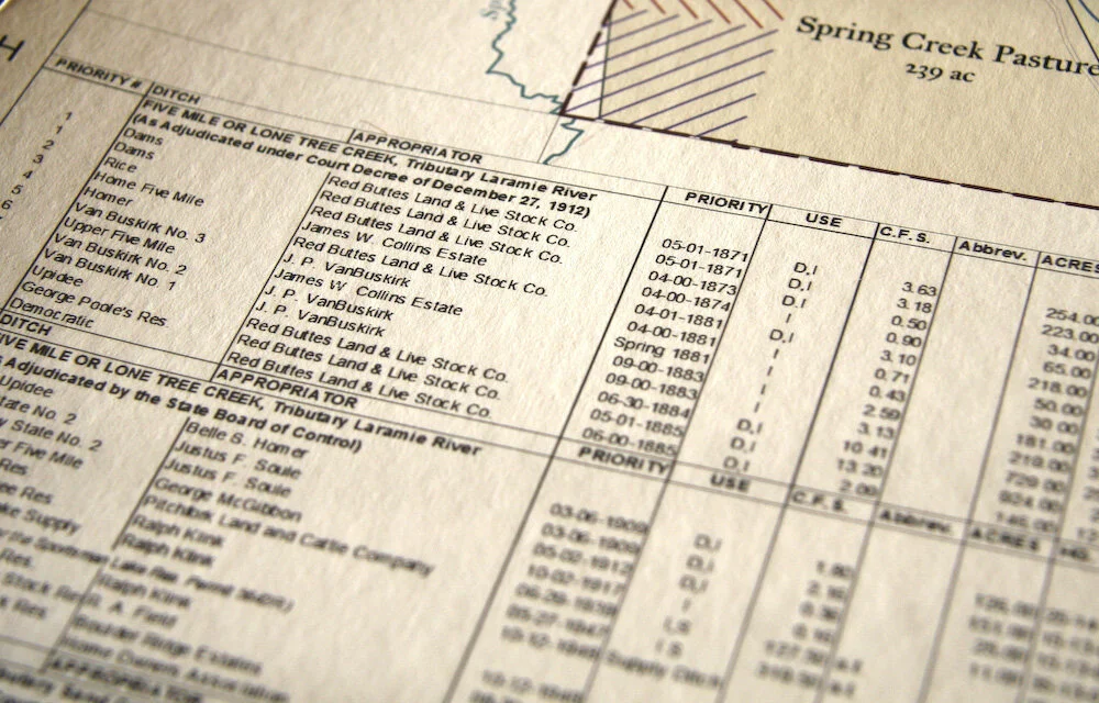
Creeks, rivers, springs, reservoirs, wells and water rights
The headquarters, barns, line camps, cow camps and cabins
Fence lines, gates, cattle guards, corrals and working pens
Roads, trails and two-tracks
Hunting and sporting ground: elk and deer country, blinds, fishing water
Historic homesteads, old cabins, cemeteries and native trails
A condensed history of the ranch, set within the print
Legacy and History
For many ranching families the map is a record of a legacy: the country a family built over generations, and the people and places behind it. Where the history runs deep, Anthony researches it in full, county records, old maps, and the recollections of those who worked the land, and sets a condensed account within the framed print itself.
At the EV Ranch in Colorado, eighty-five thousand acres on the edge of the Flat Tops, that meant the full four generations: the cabin where the founder honeymooned in 1945, the crumbling homesteads, the stories of the families who worked the land and moved on. A week after Anthony left, a wildfire came within fifty yards of the ranch boundary. The map remains.
The Illustrations
Where a map carries illustrations, they are the work of the artist Jonathan Pointer, in pencil and gouache: the horses, the cattle and elk, the ranch house in its country, a working scene from the land. Each is drawn from photographs taken on site, to your ranch and no other, and the original drawings are yours to keep.
Two Ways to Commission
The Full Commission
Begins with Anthony on the ranch, often across more than one season: riding and driving the country, talking to the foreman, the hands and the family, and researching the history in full. The map is drawn from the survey he gathers on the ground. This is the commission behind the ranches described here. Ranch commissions begin at $25,000 and scale with acreage, detail and the depth of research.
The Studio Map
For a smaller ranch, a map can be composed in the studio from survey data and aerial imagery, without a site visit, drawn to the same standard as every Rural Maps commission.
Printing, Framing and Delivery
Every map is printed on heavyweight, archival Giclée paper by a specialist fine-art printer in London, then crated, shipped and delivered to your door by Momart, the fine-art shippers, with all customs handled. Framing can be arranged through Derek Tanous, one of Europe's finest traditional framers. Distance is no barrier; maps have been delivered to ranches across the West and beyond.
Beyond the Frame
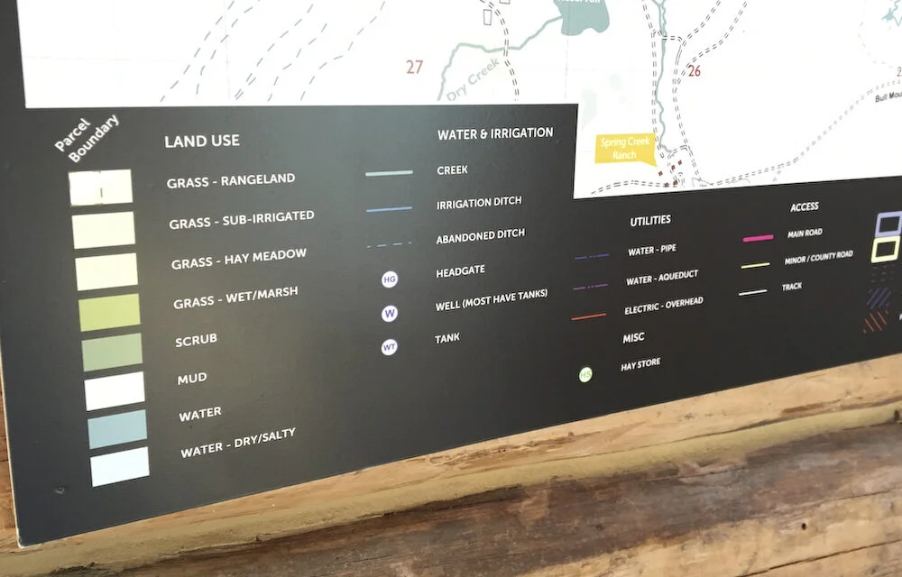
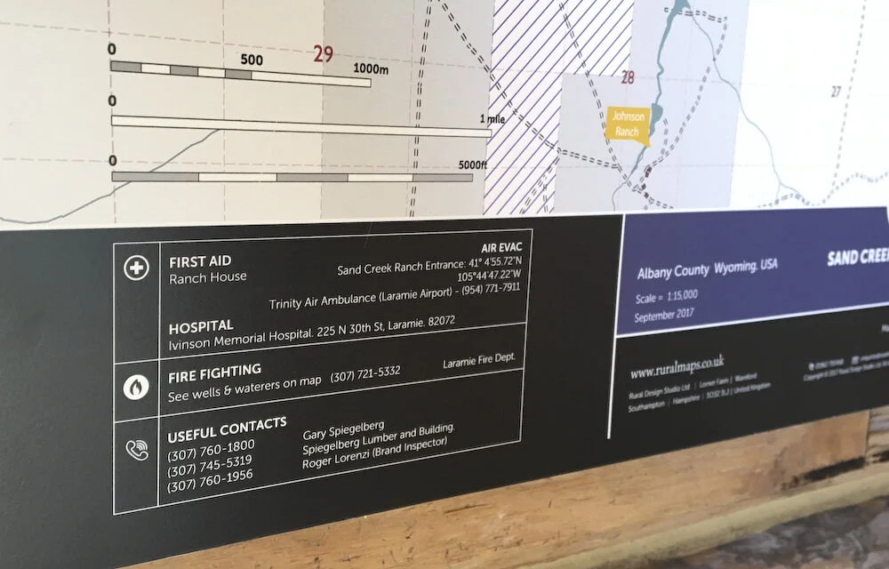
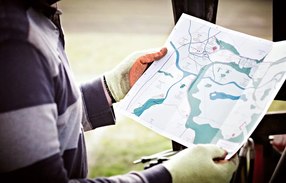
The survey behind the map does not end on the wall. Where it is useful, the same data is delivered as a working tool: a colour-coded board for the ranch office, and an app (LandID in the United States) through which managers, hands and contractors can turn layers on and off, see their position on the ground, and navigate the country offline, beyond cell signal, of particular use to anyone new to a place or working far from a tower. The map hangs in the house; the survey goes on working on the ground.
“When managing a property, you can get most things organized with the help of just one document …. A comprehensive, up-to-date map. Identify what you, your employees, contractors and advisors need to know and map it! Cropping plans, irrigation rights, field sizes, underground cables, historic features, Wayleaves, Easements, title deeds, risk assessments – they can all be referred to in an instant with the help of a map. A good map is a pleasure to use. We recommend Rural Maps. They produce the best maps we have ever seen and supply them promptly in a wide range of useful formats at a reasonable price.”
Selected ranch commissions
EV Ranch, Colorado — A bespoke decorative map of an 85,000-acre Colorado ranch on Piceance Creek, capturing four generations of a cattleman's life and the homesteaders who came before. Read the full EV Ranch case study →
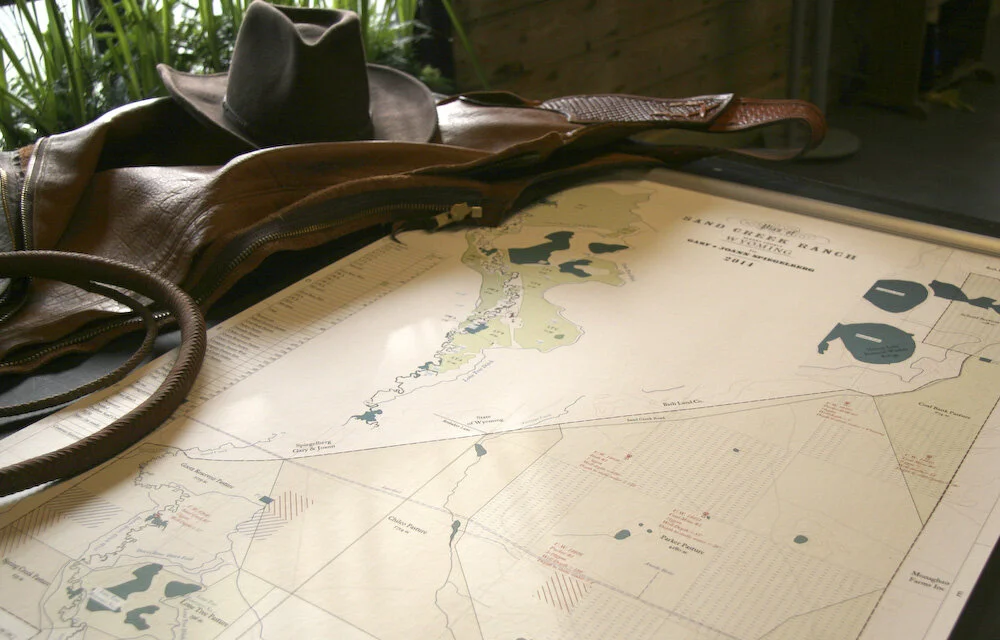
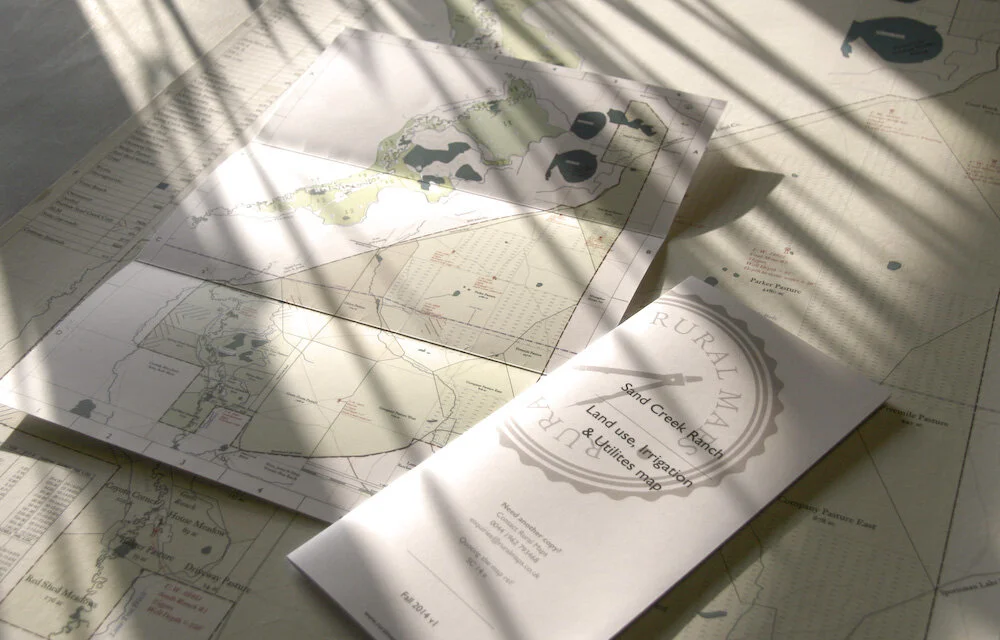
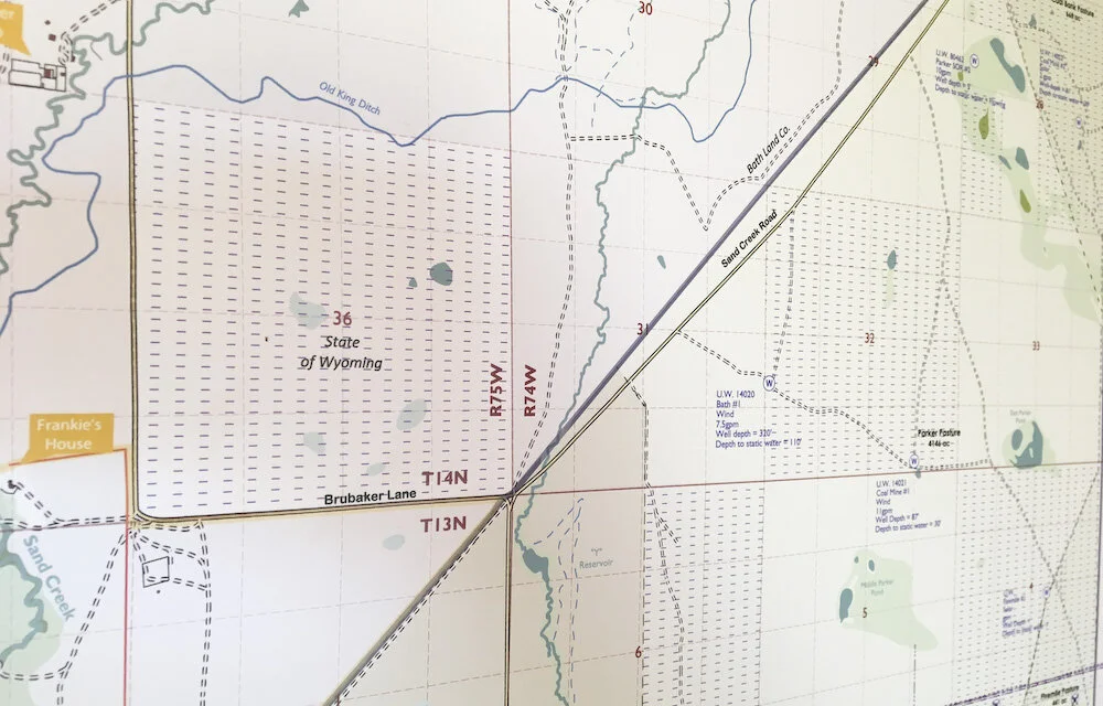
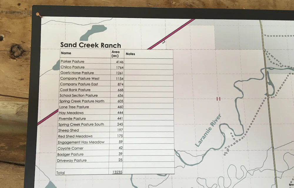
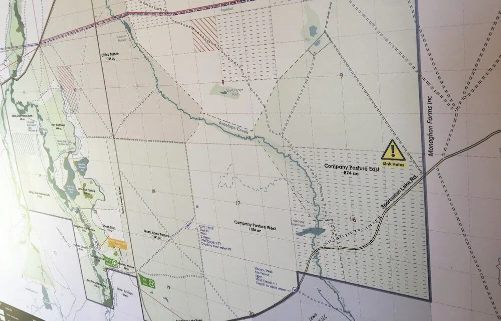
Sand Creek Ranch, Wyoming — A comprehensive functional mapping commission for a 13,000-acre tenanted ranch: wipe-clean boards for the headquarters, water- and tear-proof folded maps for the trucks and ATVs, the document that anchors the landowner-tenant working relationship. Read the full Sand Creek Ranch case study →
Amistad Ranch, Florida — A decorative illustrated map of J. Pepe Fanjul's Florida sporting ranch. [Image, links to /case-studies/amistad]

Frequently Asked Questions
-
For a full commission, yes. Anthony spends time on the ground, often across more than one season, riding and driving the country and talking to the people who run it. A studio map, made without a visit, is available for smaller ranches.
-
Large properties are mapped at appropriate scales — typically 1:15,000 for ranches of 5,000 acres and above. GPS and drone survey work supplements ground-level observation.
-
Yes. Ownership, lease and public ground, water rights, allotments and the boundaries between them are all recorded.
-
A hand-drawn map of a ranch made as a finished piece rather than a working print: surveyed on the ground, drawn to the character of the property, and framed to hang. Sizes, scales and prices are on the pricing page.
-
A printed or GIS map is a practical working tool. A bespoke map is drawn by hand and made for the wall, a record of the place to keep and pass on. Because it is drawn rather than painted, it can still be revised and reprinted as the land changes, and many owners keep both.
-
Printed in London and shipped by Momart, the fine-art handlers, who build a custom case, manage customs, and deliver and install at your door, anywhere in the West.
-
Commissions begin at $25,000 and scale with acreage, scale and the depth of historical research. A studio map without a site visit is available for smaller ranches. Full figures are on the US pricing page.
-
Yes — this is one of the most common reasons for a US commission. The knowledge held by the outgoing team - the field names, the water systems, the things that were never written down can disappear very quickly. A map made at the point of transition captures it permanently.